
Description
[From the title page]
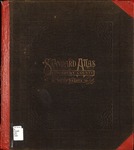
"Standard atlas of Kingsbury County, South Dakota : including a plat book of the villages, cities and townships of the county. map of the state, United States and world, patrons directory, reference business directories and departments devoted to general information, analysis of the system of U.S. land surveys, digest of the system of civil government, etc. etc."
Due to file size this item has been separated into two files.
The primary file includes: the cover; title page; table of contents; outline map of Kingsbury County; and maps of De Smet, Lake Preston, Iroquois, Arlington; Le Sueur, Spirit Lake, Hartland, Badger, Manchester, Baker, Denver, Oldham, Esmond, Mathews, Whitewood and Spring Lake townships.
The supplemental file includes: a map of South Dakota, the United States, a World map, Patrons' Reference Directory of Brookings County, illustrations, and page one of an Analysis of the System of U.S. Land Surveys and a digest of the system of civil government, etc.
Publication Date
1909
Subject Terms
Kingsbury County (S.D.) -- Maps
Kingsbury County (S.D.) -- Directories
Publisher
Geo. A. Ogle & Co.
City
Chicago
Disciplines
Geography | United States History
Copyright
This item is in the public domain.
Recommended Citation
Geo. A. Ogle & Co., "Standard atlas of Kingsbury County, South Dakota" (1909). Rare Books, Manuscripts,Government Documents, and Atlases. 2.
https://openprairie.sdstate.edu/archives_rare-books/2