
Preview
Creation Date
2016
Description
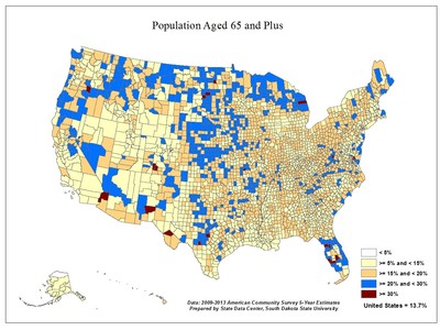
This is a county level map of the United States showing population that is aged 65 or older. Data is from the 2009-2013 American Community Survey 5-Year Estimates.
File Size: 296.9 KB
Dimensions: 1200 x 900
2016
This is a county level map of the United States showing population that is aged 65 or older. Data is from the 2009-2013 American Community Survey 5-Year Estimates.
File Size: 296.9 KB
Dimensions: 1200 x 900